Mathura–Vrindavan Master Plan 2031: What It Says About Where to Buy
A plain reading of the Mathura Vrindavan Master Plan 2031: what MVDA zones residential, where growth is pushed, and how to check your plot's zone first.
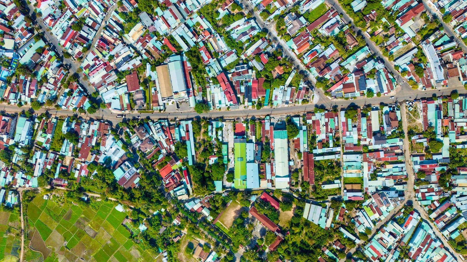
Photo: Duy Nguyen / Pexels
The Mathura Vrindavan Master Plan 2031 is the map that decides what land in the MVDA area may legally be used for. If a plot you like sits in a residential zone with a sanctioned layout, you are on firm ground; if it sits in a green belt, an agricultural pocket or a proposed road alignment, no amount of paperwork from the seller will fix that later. This guide explains what the plan is, how to read it, and what it implies for Govardhan and the Vrindavan side.
What the master plan is, and what it is not
Every development authority in Uttar Pradesh prepares a Mahayojana (master plan) for a target year. MVDA's current one runs to 2031. It divides the development area into land-use zones: residential, commercial, industrial, public and semi-public, parks, green belt, forest, water bodies and transport. The legend on the published map also marks specific reservations such as transport nagar, bus stands, a proposed circumnavigation (parikrama) route, medical and technical colleges, and social afforestation belts.
Two things the plan is not. It is not a list of approved colonies; that is a separate MVDA record. And it is not a construction permission; that comes from a sanctioned building plan under the bye-laws. Think of the plan as the first filter, not the last. Our explainer on what MVDA approval means covers the second and third filters.
How the plan was approved
The MVDA board cleared the Master Plan 2031 at a meeting chaired by the Agra Divisional Commissioner on 1 November 2022. That meeting also brought the pilgrimage towns of Gokul, Mahavan and Baldev into the authority area, and Amar Ujala noted it was the first time the plan was prepared in digital form, with departmental infrastructure such as power distribution and fire stations mapped onto it.
The plan came back to the board at its 100th meeting on 21 February 2024, where it was approved again along with residential schemes at Jait and Bati, an updated set of 2008 bye-laws, and an e-auction route for the authority's vacant plots and flats. Since then MVDA's website has published the plan sheets and the Model Building Construction and Development Bye-laws and Zoning Regulations, 2025.
The seven sheets and what they cover
MVDA does not publish the plan as one map. It is split into seven parts, and knowing which sheet covers your area saves time:
- Kosi–Chhata–Nandgaon–Barsana
- Chaumuha–Ral–Govardhan
- Govardhan–Ral
- Sonkh–Govardhan
- Mathura
- Mathura–Vrindavan
- Farah
Govardhan appears on three sheets, which tells you how much of the town's surroundings are already inside planned territory. Vrindavan, Sunrakh, Chhatikara and the Yamuna belt sit on the Mathura–Vrindavan sheet. MVDA also publishes village sajra (cadastral) plans, so you can place an exact khasra number on the zoning map rather than guessing from a road name.
Where the plan pushes growth
A published summary of the plan describes a "zonal growth" approach: new residential townships steered away from the congested temple cores, with Raya Road, Govardhan Road and Barsana named as residential priorities, dedicated zones for hotels and parking to serve pilgrims, and no-construction zones along the Yamuna riverfront and around historic kunds. The same summary mentions widening of the Vrindavan Parikrama Marg to as much as 15 metres in sections and a proposed 50 km mass-transit corridor. Treat those last two as intentions, not commitments; the plan reserves land, it does not fund works.
What we can see happening on the ground fits the pattern. In September 2026 the MVDA board, at its 110th meeting, approved sending a proposal to the state government to add 93 villages from three tehsils to its area, and gave in-principle approval to a 117-hectare land-pooling township at Chhata near the Delhi–Agra highway. One local report counts 41 of the 93 villages in Govardhan tehsil and 47 in Mathura tehsil. Once the state ratifies the expansion, land-use control and bye-laws extend to those villages too.
What this implies for Govardhan
For a buyer, MVDA's expansion around Govardhan cuts two ways.
First, it raises the bar for informal plotting. Land inside the authority area needs a sanctioned layout before it can be sold as residential plots, and unapproved colonies can face demolition or denial of services. That is a good thing if you are buying in an approved layout and a bad thing if you have been offered a cheap "plot" on undeclared farmland along the parikrama.
Second, it brings planned roads and reservations closer. A plot next to a proposed road widening can gain frontage or lose a strip of land. Check the plan sheet for the parikrama marg and Govardhan Road alignments before you fall in love with a corner plot. Our Govardhan projects, Girraj Pathway at Aanyor and Govardhanlok and Girraj Enclave at Jamunavata, carry MVDA approval; you can see their details at /projects. The comparison in Vrindavan vs Govardhan discusses the price and lifestyle trade-off separately.
What this implies for Sunrakh and the Vrindavan side
Sunrakh, Chhatikara Road and the Yamuna belt are where most new Vrindavan-side colonies have come up in the past decade. The plan's no-construction zones along the river matter here: land close to the Yamuna may be marked as floodplain or green, however attractive the view. On the Sunrakh side, the sources we could open do not spell out land use parcel by parcel, so we will not guess. Ask for the land-use extract for the exact khasra numbers, and read the Mathura–Vrindavan sheet yourself. Our Sunrakh Road area guide has the local detail.
How to read the plan for a specific plot
You do not need a planner. Follow this order:
| Step | What to do | What you learn |
|---|---|---|
| 1 | Get the khasra numbers from the seller's khatauni | The exact revenue parcels being sold |
| 2 | Open the village sajra on MVDA's site and locate those khasras | Where the parcels sit on the ground |
| 3 | Overlay on the correct master plan sheet | The land-use zone and any road or green reservation |
| 4 | Ask MVDA for the layout sanction number for the colony | Whether the colony, not just the zone, is approved |
| 5 | Check the land-use declaration under the UP Revenue Code | Whether the land has legally left agricultural use |
Step 3 is where most surprises appear. If the colour under your plot is green belt, agricultural or a proposed road, stop. If it is residential, move to steps 4 and 5. Our guide on how to read a layout master plan explains the developer's own drawing, which is a different document from MVDA's zoning plan.
Limits of the plan, honestly stated
Master plans get revised, and boundaries move. Villages proposed for inclusion in 2026 are not yet under MVDA control until the state notifies them. The plan reserves land for roads and transit that may take years or never be built. And a residential zone does not guarantee water, power or drainage; those depend on the layout and on the local body. Use the plan to rule places out, not to promise yourself a future.
What this means for you
Before you pay a token anywhere in Mathura, Vrindavan or Govardhan, spend one evening with the MVDA plan sheets and the village sajra. Confirm the zone, then confirm the layout sanction, then confirm the land-use declaration. If a seller cannot show you where the plot sits on the Master Plan 2031, that is your answer. Our team walks buyers through these three checks on every site visit; you can arrange one through /contact.
Frequently asked questions
What is the Mathura Vrindavan Master Plan 2031?+
It is the land-use plan (Mahayojana) of the Mathura-Vrindavan Development Authority for its whole development area up to the year 2031. It marks which land is residential, commercial, industrial, green belt, forest or road, and it is the basis on which MVDA sanctions layouts and building plans. The MVDA board cleared it in November 2022 and approved it again at its 100th meeting in February 2024.
Where can I see the Master Plan 2031 map?+
MVDA publishes it on its website, mvdamathura.com, under Master Plan. The plan is split into seven sheets: Kosi-Chhata-Nandgaon-Barsana, Chaumuha-Ral-Govardhan, Govardhan-Ral, Sonkh-Govardhan, Mathura, Mathura-Vrindavan and Farah, plus a full PDF. The authority also publishes village sajra (cadastral) maps, which help you place a specific khasra number on the plan.
Does a residential zone on the master plan mean a colony is approved?+
No. The master plan says what the land may be used for. A colony is approved only when MVDA has sanctioned its specific layout and the land has been converted from agricultural use. Both steps matter. A plot can sit in a residential zone and still be part of an unapproved colony, so ask for the layout sanction letter, not just the zone.
What does the master plan mean for Govardhan?+
Govardhan appears on three of the seven plan sheets, and in September 2026 the MVDA board proposed adding 93 more villages from three tehsils to its area, with one local report counting 41 of them in Govardhan tehsil. In practice, more of Govardhan is coming under planned development and bye-law control, which favours approved, laid-out colonies over informal plotting.
Is Sunrakh inside the master plan area?+
Sunrakh lies on the Vrindavan side and falls within the Mathura-Vrindavan sheet of the plan, but the sources we could open do not spell out its land use parcel by parcel. Before buying there, ask MVDA or the developer for the land-use extract for the exact khasra numbers, and match it against the sheet yourself.
Sources
- Mathura-Vrindavan Development Authority — official website (Master Plan 2031, online services)
- MVDA — Master Plan 2031 sheets and PDF
- Amar Ujala — Master Plan 2031 approved; Gokul, Mahavan and Baldev to join the authority area (Nov 2022)
- Amrit Vichar — 100th MVDA board meeting approves Master Plan 2031 (21 Feb 2024)
- Amar Ujala — MVDA's jurisdiction to expand: 93 villages, 110th board meeting (19 Sep 2026)
- TNP News — MVDA in-principle approval for 117-hectare Chhata township; 93 villages (20 Sep 2026)
- MapInside — Mathura-Vrindavan Development Master Plan map legend
- Homeswala — What is the Mathura-Vrindavan Development Authority Master Plan 2031?
mvdamaster planmathuravrindavangovardhanland use